


Do you know how most organizations use urban noise maps for traffic noise management?
Release time:
2025-07-04 15:31
Source:
Urban Noise Map: The "Smart Eye" for Traffic Noise Control
On a weekend afternoon, I wanted to open the window to enjoy a moment of peace, but the continuous roaring of passing vehicles came from outside. Traffic noise has become a "modern ailment" that urban residents find hard to escape. According to statistics, although the average equivalent road traffic noise level in China remains generally stable amid fluctuations, nighttime exceedances cannot be ignored. Facing this stubborn problem, an invisible yet crucial "map"—the urban noise map—is gradually becoming a core tool for managing traffic noise.
The urban noise map is by no means a traditional paper map. It relies on powerful Geographic Information Systems (GIS) and precise noise prediction models (such as the internationally recognized CNOSSOS-EU, ISO 9613, etc.), inputting massive data on traffic flow, vehicle type proportions, road structure, vehicle speed, terrain, building distribution, and meteorological data into professional software (widely used in the industry such as SoundPLAN noise simulation and prediction platforms). After complex calculations, it ultimately generates dynamic noise distribution visual maps covering the entire urban area at different times (day and night), intuitively revealing the spatial patterns and intensity changes of noise pollution.

How does this "smart map" empower urban managers to precisely reduce noise?
1) Planning first, avoiding noise conflicts at the source: Before planning new roads or large residential developments, the noise map can act as a "prophet." Using tools like SoundPLAN to simulate noise impact ranges and intensities under different planning schemes helps decision-makers optimize road alignments and reasonably arrange buffer distances between noise-sensitive buildings (schools, hospitals, residential areas) and traffic arteries, avoiding the passive situation of "road built, complaints follow" from the source. London extensively used noise map simulations during the planning of the Crossrail 2 project to guide route optimization and noise reduction facility layout.
2) Precise measures, making noise reduction investments targeted : Facing noise complaint hotspots in built-up areas, the noise map acts like a precise "diagnostic instrument." It can clearly locate areas exceeding standards and identify main noise sources (such as road sections with heavy truck traffic or frequent honking caused by sharp bends and steep slopes), providing targeted evidence for formulating efficient and economical control plans. Zurich prioritized laying low-noise asphalt on roads around residential areas with severe nighttime noise exceedances and implemented stricter restrictions on heavy trucks during specific periods, significantly improving residents' nighttime rest environment.
3) Dynamic evaluation, tracking governance effectiveness: Are noise reduction measures truly effective? The noise map is an authoritative "evaluator." By generating comparison maps before and after implementing noise barriers, low-noise pavement upgrades, or traffic organization optimizations (such as dedicated truck lanes or optimized signal timing to reduce sudden stops and starts), it can quantitatively assess the actual noise reduction effect (e.g., reducing 3-5 decibels), providing solid data support for subsequent investments and strategy adjustments. After Shenzhen applied sound barriers and low-noise pavement on parts of Shennan Avenue, noise maps showed an average nighttime noise reduction of about 4 decibels at sensitive points along the route, earning residents' recognition.
4) Public participation, enhancing governance transparency and consensus : More and more cities publish noise maps online. Residents can conveniently check noise levels at their residences and understand noise sources, greatly improving governance transparency and public engagement. Online platforms often integrate complaint and reporting functions, helping management departments collect information and respond to demands more efficiently. EU countries regularly publish and update interactive noise maps for the public in accordance with the Environmental Noise Directive, becoming an important embodiment of citizens' environmental right to know.
Although noise map technology has become increasingly mature, challenges remain. The real-time accuracy of data (such as dynamic traffic flow changes) still needs improvement, and the simulation accuracy in complex urban environments (such as sound reflections between dense high-rise buildings) requires enhancement. In the future, integrating Internet of Things (IoT) real-time monitoring data, artificial intelligence (AI) optimized models, and big data analysis to build a dynamically updated, more predictive and early-warning capable "smart noise brain" is an inevitable direction for technological development.
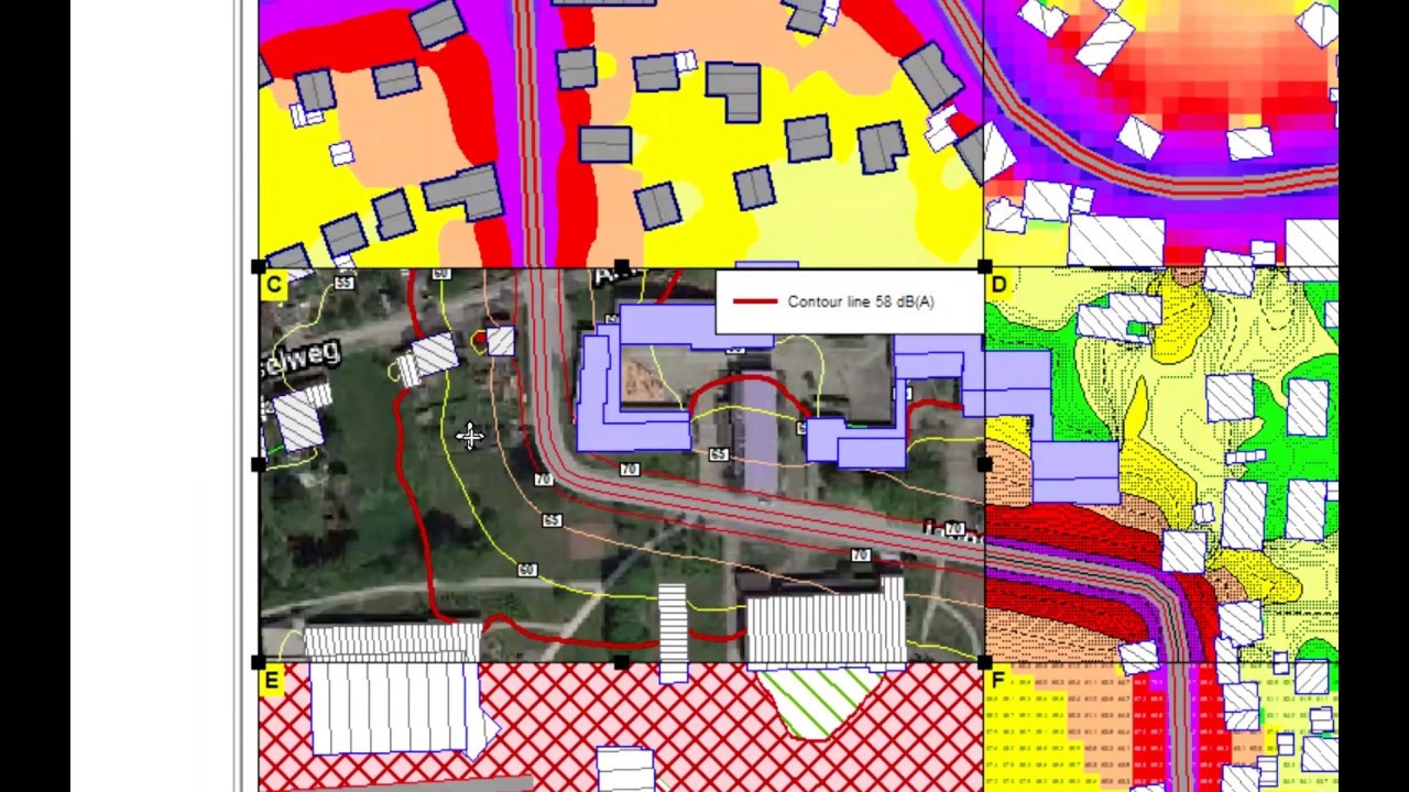
The urban noise map, this invisible yet increasingly detailed "urban soundscape map," has moved from the laboratory to the forefront of governance. It provides managers with a "wise eye" for scientific decision-making, allowing traffic noise control to move away from "blind men touching an elephant" toward precision, dynamism, and intelligence. When the urban noise map is truly deeply integrated into the entire process of planning, construction, and management, the vision of a quiet and livable city will no longer be far away.
Noise Map,Noise Simulation and Prediction,SoundPLAN