


What are the ingenious uses of noise maps generated by SoundPLAN software in targeted noise control?
Release time:
2025-06-13 15:30
Source:
Noise Mapping is a tool that visualizes the noise distribution in a specific area through computer simulation technology combined with Geographic Information Systems (GIS). SoundPLAN software uses advanced acoustic calculation models, such as international standard algorithms ISO 9613 and CNOSSOS-EU, to accurately predict the propagation patterns of different noise sources.
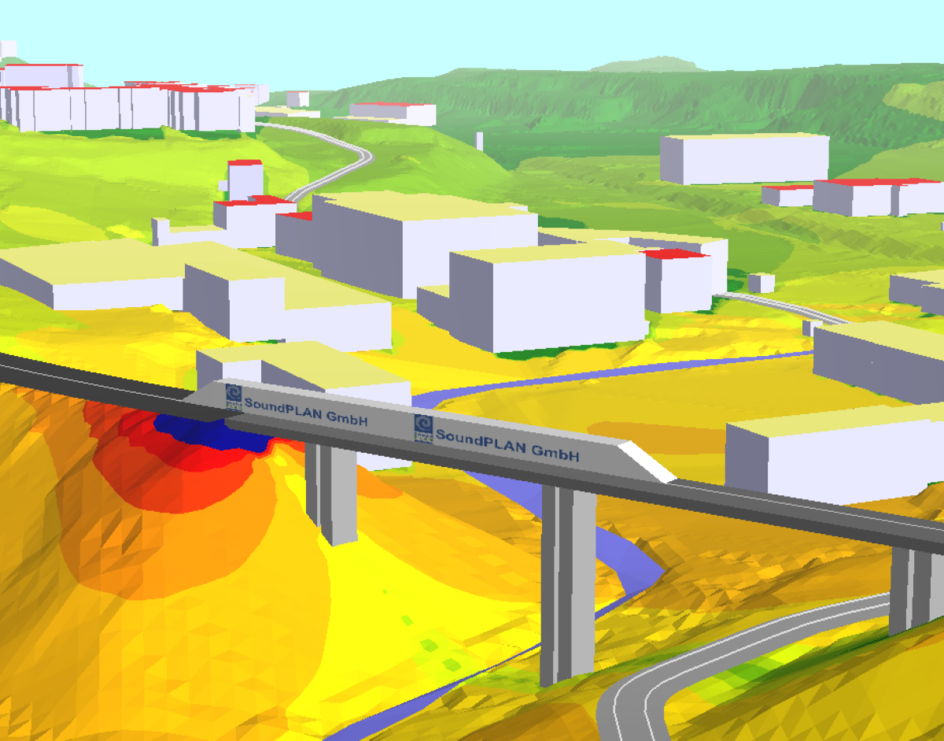
Compared with traditional noise monitoring, noise maps generated by SoundPLAN have the following advantages:
- Full coverage: can simulate noise distribution across an entire city or key areas, avoiding the limitations of single-point monitoring.
- Dynamic prediction: predicts noise changes at different times by integrating factors such as traffic flow, building layout, and meteorological data.
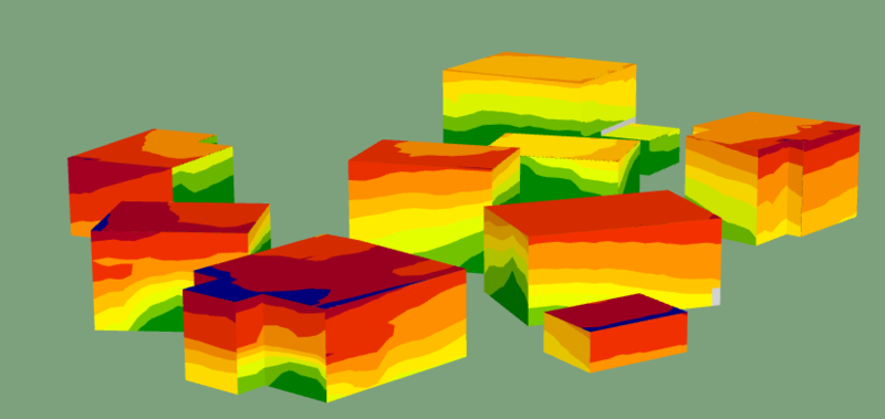
- Source identification: intuitively displays the locations of major noise sources through color layering (e.g., red represents high noise areas, blue represents low noise areas).
For example, the city of Stuttgart in Germany used SoundPLAN noise maps to successfully identify that nighttime excessive noise mainly came from highways and railways, and optimized the layout of sound barriers accordingly, reducing noise in affected residential areas by 5-7 decibels.
2. Targeted Governance: From "One-Size-Fits-All" to Precise Measures
The key to noise control is "targeted treatment." SoundPLAN noise maps provide environmental protection departments with scientific decision-making bases, making control measures more targeted.
(1) Traffic Noise Optimization
Traffic noise is the main source of urban noise, accounting for more than 60% of environmental noise pollution. SoundPLAN can simulate the effects of different noise reduction schemes, such as:
- Low-noise pavement: laying porous asphalt in noise hotspot areas can reduce noise by 3-5 decibels.
- Sound barrier optimization: adjusting the height and position of barriers based on noise maps to improve noise reduction efficiency.
For example, Beijing applied SoundPLAN simulation on some sections of the Fifth Ring Road to optimize sound barrier design, reducing noise in adjacent residential areas by 4 decibels and saving about 15% in control costs.
(2) Industrial Noise Control
For factory-dense areas, SoundPLAN can simulate the noise contribution of different equipment to help enterprises optimize layout. For example:
- Equipment soundproofing: prioritize installing soundproof covers on high-noise equipment such as fans and compressors.
- Plant layout: locate high-noise workshops away from sensitive areas and use green belts to reduce noise propagation.
The Port of Rotterdam in the Netherlands used SoundPLAN to analyze port machinery noise, improving compliance rates in surrounding communities by 20% through adjusting operation times and adding soundproof walls.
(3) Urban Planning and Building Noise Reduction
SoundPLAN noise maps can assist urban planning, such as:
- Building layout optimization: avoid placing sensitive facilities like schools and hospitals in high-noise areas.
- Green noise reduction: simulate the noise reduction effects of trees and shrubs to guide the construction of ecological sound barriers.
Studies show that a 30-meter-wide green belt can reduce noise by 6-10 decibels. Shenzhen used SoundPLAN simulation in new area planning to reasonably arrange green spaces and building clusters, reducing regional environmental noise by 8 decibels.
3. Future Outlook: Integration of Smart Cities and Noise Control
With the development of smart city technologies, SoundPLAN noise maps can be combined with the Internet of Things (IoT) to achieve real-time noise monitoring and dynamic regulation. For example:
- Intelligent traffic management: adjust traffic light timing based on noise data to reduce nighttime vehicle honking.
- Public participation: open noise map query platforms to let residents understand surrounding noise conditions and participate in governance.
The European Union requires member states to update noise maps every five years and formulate action plans based on them. China's "14th Five-Year Plan for Noise Pollution Prevention and Control" also explicitly proposes promoting noise map technology to enhance precise noise control capabilities.
Conclusion
SoundPLAN noise maps are not only tools for noise assessment but also "navigators" for targeted governance. Through scientific modeling and data-driven approaches, urban managers can more efficiently identify noise sources and optimize noise reduction measures, ultimately achieving "restoring quiet for the people." In the future, with technological advancements, noise maps will play a greater role in smart environmental protection.
"Targeted control" noise,SoundPLAN software,Noise Control,Noise Simulation Prediction